Outpost / Offline GMRS mapping
Where does the signal reach?
An offline basecamp tool for planning GMRS coverage tests and recording what comes through.
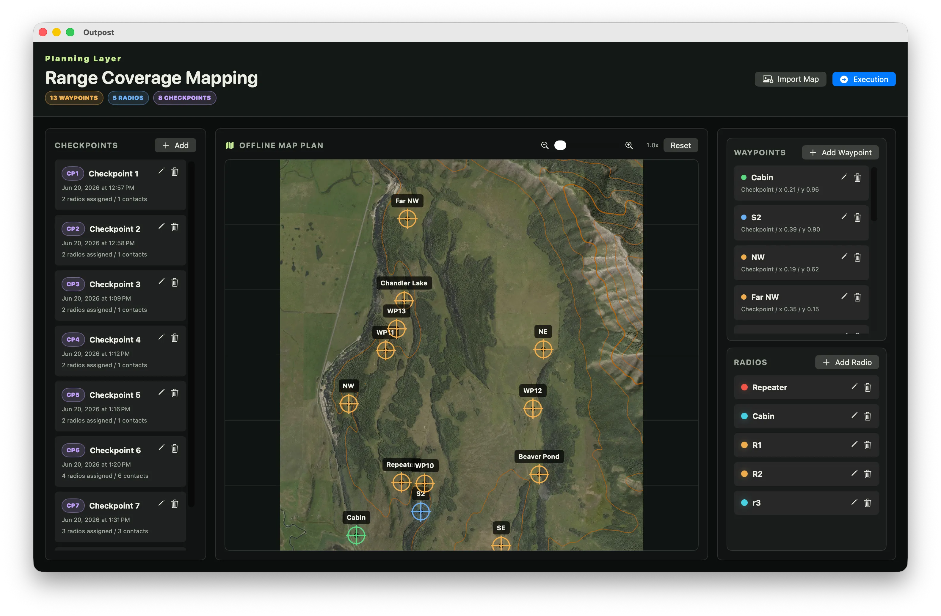
Built for hills, trees, and radio checks
I needed an offline mapping tool to help build a GMRS radio coverage map of private property with several hills and dense forest. The main intention was to use it as a mobile basecamp at a potential repeater location.
Outpost gives that basecamp a map-based plan and a place to record observations. Prepare locations and expected contacts before testing, then log signal ratings and notes as the radio checks happen.
How it works
- 01 / Prepare
Bring your own map
Import and crop a map image. Add editable waypoints over it to mark the locations you want to use.
- 02 / Plan
Put radios in place
Create checkpoints, assign radios to waypoints, and specify the contacts you expect to test.
- 03 / Review
Record what happened
Select the radios involved in a contact and log a signal rating and notes against the checkpoint.
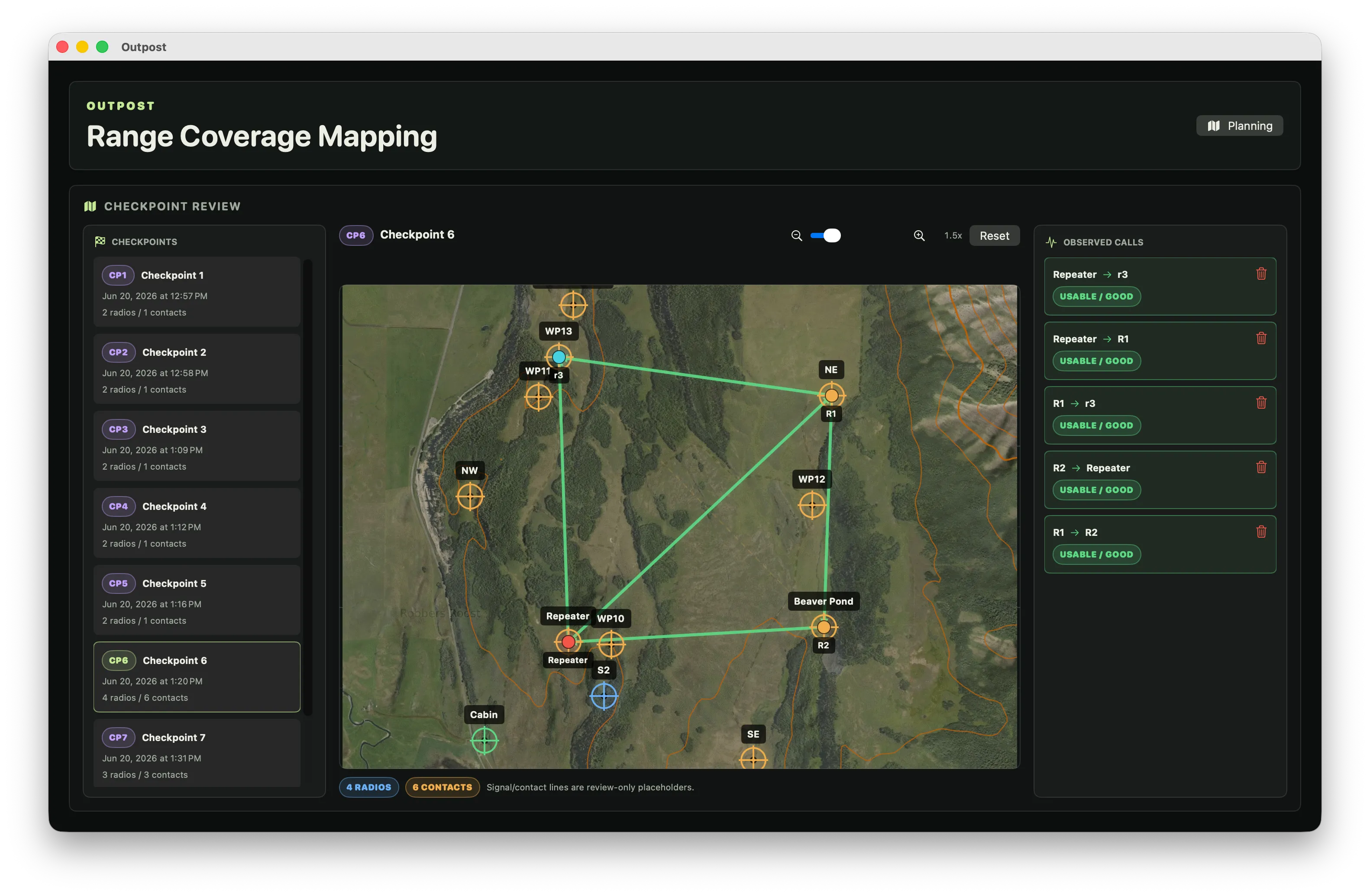
Field observations, kept with the plan
The map provides the setting; the radio checks provide the observations. Outpost records contacts and their signal ratings rather than predicting coverage from terrain. Waypoints remain editable, and the plan and recorded results are saved locally.